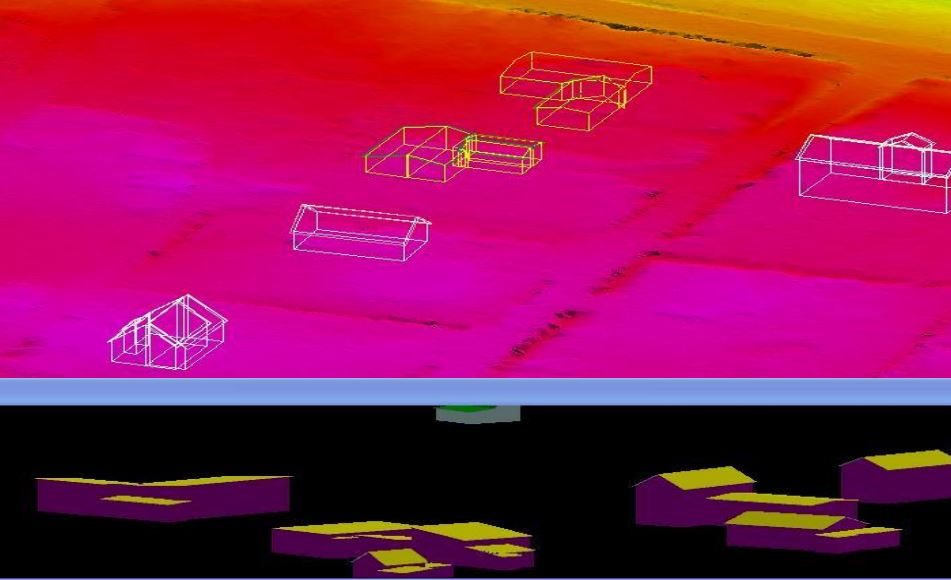
3D Building and Infrastructure Modeling
LiDAR Data Services expertise lies in the efficient Building Information Modeling tailored to different requirements. These are essentially digitally generated Building 3D Models that provide a near-accurate representation of urban areas, including various terrain, buildings, and other infrastructure.
These models are not just three-dimensional models; more deeply, they are used to study how urban systems function. These elaborate maps are created using a variety of photogrammetry software programs. These act as assets and are distributed across various applications such as navigation and other location-based services. More specifically, we are characterized by the accurate extraction of features on maps.
Accurate measurements and analysis allow various stakeholders to easily visualize future projects before they are realized. Our Building 3D Models are also used in the AEC industry to improve situational awareness and create strategic advantages that make field operations more efficient. Furthermore, disaster management is also an area that relies heavily on 3D models to aid response and recovery.
Works
Our Work